
Why is it a so difficult problem for navigating in a three-dimensional world?
The excerpt note is about spatial cognition in non-horizontal environments by Jeffery K. J. et al., 2013.
Jeffery, Kathryn J., Aleksandar Jovalekic, Madeleine Verriotis, and Robin Hayman. “Navigating in a three-dimensional world.” Behavioral and Brain Sciences 36, no. 5 (2013): 523-543.
The real world is neither simple nor two-dimensions adds a number of new problems for a navigator to solve.
Moving in a volumetric space is computationally complicated, because of the increased size of the representation needed, and because rotations in three dimensions interact.
It remains an open question how the brain has solved these problems and whether the same principles of spatial encoding operate in all three dimensions or whether the vertical dimension is treated differently.
An animal that is trying to navigate in 3D space needs to know three things—how it is positioned, how it is oriented, and in what direction it is moving. Further, all these things require a reference frame: a world-anchored space-defining framework with respect to which position, orientation, and movement can be specified. There also needs to be some kind of metric coordinate system—that is, a signal that specifies distance and directions with respect to this reference frame.
The core question for animal navigation, therefore, concerns what the reference frame might be and how the coordinate system encodes distances and directions within the frame.
The real world is often not planar—air and water, for example, allow movement in any direction and so are volumetric.
In this article, the authors divide three dimensional environments into those that are locally planar surfaces, which allow movement only in a direction tangential to the surface, and those that are volumetric spaces (air, water, space, and virtual reality) in any direction is unconstrained. Second, even if real environments might be (locally) planar, the planes may not necessarily be horizontal. These factors are important in thinking about how subjects encode and navigate through complex spaces.
What does the vertical dimension add to the problem of navigation?
The vertical dimension makes the problem of navigation considerably more complex, for a number of reasons.
First, the space to be represented is much larger, since a volume is larger than a plane by a power of 3/2.
Second, the direction information to be encoded is more complex, because there are three planes of orientation instead of just one. Furthermore, rotations in orthogonal planes interact such that sequences of rotations have different outcomes depending on the order in which they are executed (i.e., they are non-commutation) which adds to processing complexity.
Third, the vertical dimension is characterized by gravity, and by consequences of gravity such as hydrostatic or atmospheric pressure, which add both information and effort to the computations involved.
Finally, there are navigationally relevant cues available for the horizontal plane that are absent in the vertical: for example, the position of the sun and stars, or the geomagnetic field.
The questions concerning the brain’s map of space, then are: What encoding scheme does it use for navigation either over undulating surfaces or in volumetric spaces? Is the vertical dimension encoded in the same way as the two horizontal ones, as in the volumetric map? Is it ignored entirely, as in a surface map, or is it encoded, but in a different way from the horizontal dimensions, as in the bicoded map?
A key question to be answered concerning the representation of three-dimensional space is how information from the vertical dimension is incorporated into the spatial representation.
How cues from the vertical dimension may be processed?
How these cues may be used in self-localization and navigation?
Navigation in Multilayer Environments
Multilayer environments- such as trees, burrow systems, or buildings – are those in which earth-horizontal x-y coordinates recur as the animal explores, due to overlapping surfaces that are stacked along the vertical dimension.
The core question concerning multilayer environments is the degree to which the layers are represented independently versus being treated as parts within an integrated whole.
Further studies at both behavioural and neurobiological levels will be needed to determine how multiple overlapping levels are represented and used in navigation.
Navigation in a Volumetric Space
Volumetric spaces such as air and water allow free movement in all dimensions. Relatively little navigational research has been conducted in such environments so far. One reason is that it is difficult to track animal behaviour in volumetric spaces. Many of studies still address navigation only in the earth-horizontal plane, ignoring possible variations in flight or swim height.
Neurobiological Studies in Three Dimensions
Behavioural research exploring three-dimensional navigation and seen clear evidence that 3D information is used by animals and humans, although the exact nature of this use remains unclear.
A parallel line of work has involved recordings from neurons that are involved in spatial representation. This approach has the advantage that it is possible to look at the sensory encoding directly and make fine-grained inferences about how spatial information is integrated. While most of this work has hitherto focused on flat, two-dimensional environments, studies of three-dimensional encoding are beginning to increase in number.
4.3 Neural Encoding of Multilayer Environments
Very little work has examined neural encoding of space in multilayer environments, which is unfortunate given the theoretical importance of this issue.
There is also little work on place and grid cells in multilayer environments.
4.4 Neural Encoding of a Volumetric Space
The final and most important question concerning three-dimensional spatial encoding is whether there is metric encoding of volumetric space. As with multiplayer environments, there have been no studies done to date on neural responses to free movement through true volumetric spaces, and so the answer to this question remains open.
A volumetric map requires direction and distance to be calculated for both the horizontal and vertical dimensions.
What about distance in three dimensions? Because grid cells seem to provide the odometric representation for horizontal distance by virtue of their regularly spaced grid fields, we could predict that the periodicity observed in the horizontal dimension might be part of a three-dimensional, lattice-like arrangement of spherical fields.
There are two ways of close-packing spheres in a volume, termed hexagonal and face-centered cubic, respectively. Since we already know that the grid array on the horizontal plane is hexagonal close-packed, if either of these volumetric arrangements were to pertain, then we would predict it should be the hexagonal form.
Is the Cognitive Map Bicoded?
‘Bicoded’, that is, using a different encoding scheme for horizontal than for vertical space.
A volumetric map, is metric (i.e., distances and directions are explicitly encoded) in all three dimensions.
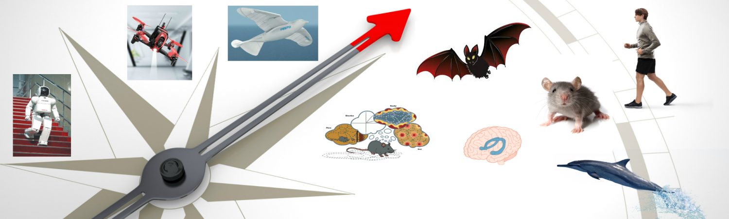
In particular, animals that have to solve three-dimensional spatial problems for which there is no planar approximation, such as those that have to path integrate across a volumetric space like the ocean, may be expected to possess a volumetric cognitive map if such a thing exists. Studies in birds, fish, or swimming and flying mammals such as cetaceans or bats have the potential to reveal whether there are spatial metric computations for travel in all three dimensions, and also whether these are integrated.
Encoding three dimensions poses considerable technical challenges for a compass system.
If the planar fragments of the cognitive map need not be oriented horizontally, then how does the animal process the vertical axis, which remains a special, and important, reference due to the effects of gravity?
To form an integrated map of large-scale space using mosaic fragments, there also should be some means of associating the local reference frames, both to one another (to enable navigation between fragments) and to earth-horizontal (to enable appropriate energy and other gravity-related calculations to be made).
For more sophisticated navigation, however, it would be preferable to weld fragments together into a larger, unitary frame that would allow for precise metric computations across the space. It may be that such a reference frame adaptation could occur with experience.
What about subjects that habitually navigate in volumetric spaces, including animals such as fish, birds and bats, and also human divers, aviators and astronauts? Do they use a surface map too?
A volumetric map requires three coordinates for position and three for direction.
Conclusion
To conclude, the authors have reviewed emerging experimental evidence concerning the encoding of three-dimensional space in animals and humans.
Evidence for true volumetric coding is, however, weak, and both behavioural and neural studies suggest the alternative hypothesis that the neural representation of space, in a wide variety of species, is metrically flat (referenced to a plane – usually the plane of locomotion) and is modulated in the vertical dimension in a non-metric way.
For further info,please read the reference (Jeffery K.J., 2013).
Jeffery, Kathryn J., Aleksandar Jovalekic, Madeleine Verriotis, and Robin Hayman. “Navigating in a three-dimensional world.” Behavioral and Brain Sciences 36, no. 5 (2013): 523-543.
About
CogNav Blog
New discovery worth spreading on cognitive navigation in neurorobotics and neuroscience
Recent Posts
- How to build a bio-inspired hardware implementation of an analog spike-based hippocampus memory model?
- How does the brain select what to remember during sleep?
- How hippocampal activity encodes numerous memories of specific events in life?
- How egocentric coding properties arise from its presynaptic inputs, and how egocentric cells represent items across different behavioral contexts?
- How the medial entorhinal cortex develops during learning and influences memory?
Tags
Categories
- 3D Movement
- 3D Navigation
- 3D Path Integration
- 3D Perception
- 3D SLAM
- 3D Spatial Representation
- AI Navigation
- Bio-Inspired Robotics
- Brain-Inspired Navigation
- Cognitive Map
- Cognitive Navigation
- Episodic Memory
- Excerpt Notes
- Flying Vehicle Navigation
- Goal Representation
- Insect Navigation
- Learning to Navigate
- Neural Basis of Navigation
- Path Integration
- Path Planning
- Project
- Research Tips
- Robotic Vision
- Self-Flying Vehicles
- Spatial Cognition
- Spatial Cognitive Computing
- Spatial Coordinate System
- Spatial Memory
- Time
- Unclassified
- Visual Cortex
- Visual Cue Cells
Links
- Laboratory of Nachum Ulanovsky
- Jeffery Lab
- BatLab
- The NeuroBat Lab
- Taube Lab
- Laurens Group
- Romani Lab
- Moser Group
- O’Keefe Group
- DoellerLab
- MilfordRobotics Group
- The Space and Memory group
- Angelaki Lab
- Spatial Cognition Lab
- McNaughton Lab
- Conradt Group
- The Fiete Lab
- The Cacucci Lab
- The Burak Lab
- Knierim Lab
- Clark Spatial Navigation & Memory Lab
- Computational Memory Lab
- The Dombeck Lab
- Zugaro Lab
- Insect Robotics Group
- The Nagel Lab
- Basu Lab
- Spatial Perception and Memory lab
- The Neuroecology lab
- The Nagel Lab
- Neural Modeling and Interface Lab
- Memory and Navigation Circuits Group
- Neural Circuits and Memory Lab
- The lab of Arseny Finkelstein
- The Epstein Lab
- Gu Lab (Spatial Navigation and Memory)
- Fisher Lab (Neural Circuits for Navigation)
- The Alexander Lab (Spatial Cognition and Memory)
- Harvey Lab (Neural Circuits for Navigation)
- Buzsáki Lab
- ……